Member Projects
29 October 2021SCGIS Academic Program Database
The SCGIS Academic Programs Database is an online and interactive list of academic degree and certificate programs that is specifically tailored to the SCGIS community.
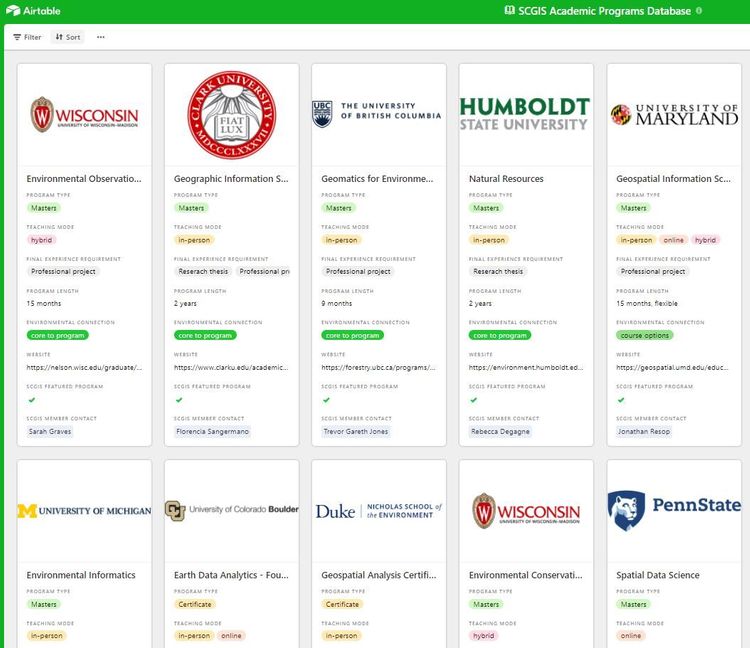
Link to view database: https://airtable.com/shrYSXwhkV8PoeuvA
Click the link above to view the live list of 21 academic programs
Purpose and focus
This database has been compiled by members of the SCGIS Communications Committee and other active SCGIS members. The purposes of this database are to:
- Serve our membership by providing relevant information to those seeking higher-education programs
- Bring additional visibility to existing programs, particularly programs associated with active SCGIS members
- Foster the connections between SCGIS and listed programs to expand the network and reach of SCGIS and promote SCGIS membership
How to view program information
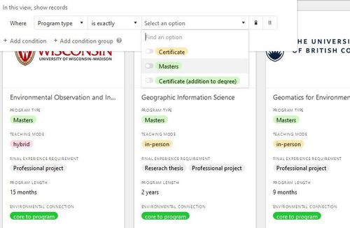
The database lists each program as a separate tile. Viewers can hover over each field or click on the tile to view all information. Viewers can also explore all programs at once or sort and filter the programs based on the criteria.
Information about each program includes:
- Program type: type of degree or credential provided
- Teaching mode: if a program can be completed in-person or online
- Final experience requirement: indicates if there is a final requirement, such as a thesis or project, required to complete the program.
- Program length: approximate time it takes to complete the program
- Environmental connection: how environmental topics are incorporated into the program
- Website
Current priority
For 2021, we are focusing on certificate or Masters programs in the US from degree-granting institutions. As we gauge interest from the community, we will expand programs to include Bachelors and PhD programs in the US and around the world. If you know of a program that you would like to include, see below for details.
If you are interested in a more comprehensive list of GIS programs that are not specific to environmental topics, check out https://www.geotechcenter.org/
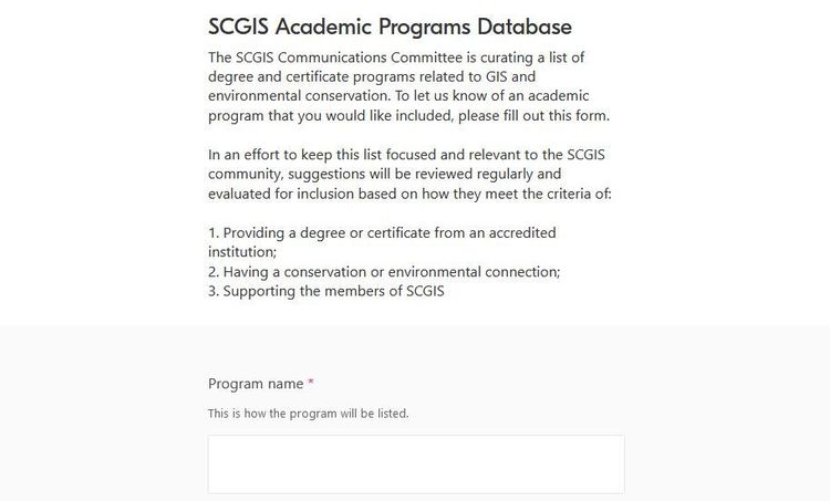
How to propose programs for inclusion
Do you know of a program you’d like to see on this list? Let us know by filling out this form. Submitted programs will be reviewed regularly by SCGIS members and the SCGIS communications committee. Proposed programs do not have to be limited to the current scope and will be added as we expand the focus of the list. We use the following criteria when deciding to include a program:
1. Provide an academic degree or certificate of completion and have complete information accessible online
2. Have an explicit connection to environmental or conservation related topics (not just GIS programs). We recognize varying levels of an environmental connection and will note these in the database:
- In an institution connected to conservation/environmental studies
- Include an environment class in the curriculum as a requirement or elective
- Allow for the student to make independent environmental connection through and instructor relationship or project
3. Prioritize programs associated with SCGIS members (alumni, instructor, faculty, student). To be included in the database as an “SCGIS featured program” the program must have an SCGIS contact person who is directly associated with the program, is an active SCGIS member, and who is willing to have their name listed alongside the program information.